


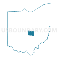
Licking County PUMA, Ohio
About
Outline

Summary
| Unique Area Identifier | 193778 |
| Name | Licking County PUMA |
| State | Ohio |
| Area (square miles) | 687.49 |
| Land Area (square miles) | 682.50 |
| Water Area (square miles) | 4.99 |
| % of Land Area | 99.27 |
| % of Water Area | 0.73 |
| Latitude of the Internal Point | 40.09360930 |
| Longtitude of the Internal Point | -82.48125060 |
Maps

Graphs
Select a template below for downloading or customizing gragh for Licking County PUMA, Ohio


Neighbors
Neighoring Public Use Microdata Area (by Name) Neighboring Public Use Microdata Area on the Map
- Columbus (Far Northeast), Gahanna & New Albany Cities PUMA, OH
- Columbus (Southeast) & Reynoldsburg Cities PUMA, OH
- Delaware County PUMA, OH
- Fairfield County PUMA, OH
- Holmes, Guernsey & Coshocton Counties PUMA, OH
- Marion, Knox & Morrow Counties PUMA, OH
- Muskingum & Perry Counties PUMA, OH
Top 10 Neighboring County (by Population) Neighboring County on the Map
- Franklin County, OH (1,163,414)
- Delaware County, OH (174,214)
- Licking County, OH (166,492)
- Fairfield County, OH (146,156)
- Muskingum County, OH (86,074)
- Knox County, OH (60,921)
- Coshocton County, OH (36,901)
- Perry County, OH (36,058)
Top 10 Neighboring County Subdivision (by Population) Neighboring County Subdivision on the Map
- Columbus city, Franklin County, OH (770,122)
- Newark city, Licking County, OH (47,573)
- Violet township, Fairfield County, OH (38,572)
- Truro township, Franklin County, OH (26,837)
- Etna township, Licking County, OH (16,373)
- Pataskala city, Licking County, OH (14,962)
- Jefferson township, Franklin County, OH (10,972)
- Heath city, Licking County, OH (10,310)
- Plain township, Franklin County, OH (9,829)
- Granville township, Licking County, OH (9,773)
Top 10 Neighboring Place (by Population) Neighboring Place on the Map
- Columbus city, OH (787,033)
- Newark city, OH (47,573)
- Reynoldsburg city, OH (35,893)
- Pataskala city, OH (14,962)
- Heath city, OH (10,310)
- New Albany village, OH (7,724)
- Granville village, OH (5,646)
- Johnstown village, OH (4,632)
- Beechwood Trails CDP, OH (3,020)
- Buckeye Lake village, OH (2,746)
Top 10 Neighboring Unified School District (by Population) Neighboring Unified School District on the Map
- Newark City School District, OH (48,273)
- Pickerington Local School District, OH (47,880)
- Gahanna-Jefferson City School District, OH (44,476)
- Reynoldsburg City School District, OH (37,631)
- Southwest Licking Local School District, OH (23,855)
- Licking Heights Local School District, OH (22,242)
- New Albany-Plain Local School District, OH (19,564)
- Big Walnut Local School District, OH (18,160)
- Tri-Valley Local School District, OH (16,652)
- River View Local School District, OH (15,044)
Top 10 Neighboring State Legislative District Lower Chamber (by Population) Neighboring State Legislative District Lower Chamber on the Map
- State House District 2, OH (174,214)
- State House District 19, OH (157,070)
- State House District 5, OH (146,156)
- State House District 91, OH (130,644)
- State House District 71, OH (126,986)
- State House District 90, OH (126,807)
- State House District 94, OH (117,946)
Top 10 Neighboring State Legislative District Upper Chamber (by Population) Neighboring State Legislative District Upper Chamber on the Map
- State Senate District 3, OH (410,561)
- State Senate District 19, OH (406,557)
- State Senate District 31, OH (403,786)
- State Senate District 20, OH (357,708)
Top 10 Neighboring 111th Congressional District (by Population) Neighboring 111th Congressional District on the Map
- Congressional District 12, OH (756,303)
- Congressional District 7, OH (683,371)
- Congressional District 18, OH (653,167)
Top 10 Neighboring Census Tract (by Population) Neighboring Census Tract on the Map
- Census Tract 73.95, Franklin County, OH (11,281)
- Census Tract 329, Fairfield County, OH (10,344)
- Census Tract 73.96, Franklin County, OH (9,839)
- Census Tract 72.10, Franklin County, OH (8,200)
- Census Tract 7562.02, Licking County, OH (8,021)
- Census Tract 7568, Licking County, OH (7,723)
- Census Tract 7577, Licking County, OH (7,446)
- Census Tract 7541.01, Licking County, OH (7,421)
- Census Tract 327.02, Fairfield County, OH (7,340)
- Census Tract 7533, Licking County, OH (7,284)
Top 10 Neighboring 5-Digit ZIP Code Tabulation Area (by Population) Neighboring 5-Digit ZIP Code Tabulation Area on the Map
- 43055, OH (59,605)
- 43068, OH (51,836)
- 43147, OH (38,440)
- 43050, OH (29,050)
- 43062, OH (27,644)
- 43004, OH (22,727)
- 43054, OH (20,566)
- 43056, OH (17,439)
- 43023, OH (13,231)
- 43031, OH (12,318)